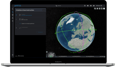
A unique platform to observe the earth

Our digital platform is designed to acquire and enhance data in the form of applications and services by its ability to aggregate diverse and complementary data sources. It is an integrated geospatial services platform with high added value, integrating personalized and automated earth observation applications. It covers the entire decision cycle, without interruption, to streamline the flow of information and accelerate decision making.
Users have intuitive and simplified access to a set of business applications, including
– the taking into account of their requests (requiring no particular spatial or technical skills) ;
– acquisition of data by satellites; their aggregation with relevant external sources and their automated processing;
– dissemination of results in the form of reports, dashboards and alerts.
EOP allows :
– Tasker – request very recent images of a particular area ;
– Access archives (commercial, in situ, free data,…)
– Analyze via pre-built dedicated applications and tools that meet the needs of ;
